NO Reproduction in Whole or in Part, on ANY, and ALL of my Pages,
 Including Text and Pictures,
 May be made, without the express Written Permission
 of Web Editor, Doug Gent
© 2015

 
NORTHERN
RADIO DEPARTMENT
HISTORY
1960’s - 2000
BC TELEPHONE CO.
CHAPTER #3

 
COASTAL 
TROPO SCATTER 
SYSTEM

 
LIST  OF  RADIO  SITES 
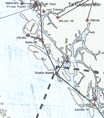
COASTAL  TROPO 
SCATTER  SYSTEM
From the North to the South

-----
Annette Island Alaska
X
Trutch Island
X
Port Hardy

This map shows location of Trutch Island
in relation to Prince Rupert and Kitimat
Also shown, Noble Mtn, Kitkatla,
Nartley Bay, Swindel Island, Klemtu,
McLean Mtn, Port Edward,
Metlakatla, and Mt Hays

Return to my BC History Index Page


Return to Home Page

Created by Doug Gent
Copyright © 2015

All Rights Reserved