NO Reproduction in Whole or in Part, on ANY, and ALL of my Pages,
 Including Text and Pictures,
 May be made, without the express Written Permission
 of Web Editor, Doug Gent
© 2016


My Dad, Phillip George Gent
Phil Gent's (1912-1982)
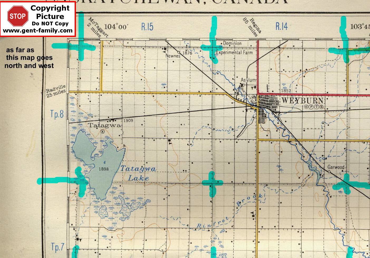
1927
  S.E.  Saskatchewan, Canada
Highway Map

SHOWING TOWNSHIP 8, SOUTH TO PART OF TOWNSHIP 7,
IN  PART OF RANGE 13,  ALL OF RANGE 14 and 15
WEST OF THE 2ND MERIDIAN

It is as far North and East, my Dad's map goes

Includes City and Towns of:
Weyburn (see note below)
Newnes

Garwood
Tatagwa

note- City of Weyburn has many of it's own web pages
also a history book, online Cemetery lists, etc.,
so I am not going to repeat their info on my SE Sask site.
OK I lied, had some postcards sent to me, so added a small page
Weyburn

All Railways shown are CPR
Also shows the Dominion Experimental Farm location
Tatagwa Lake
Rinfret Brook


Reference Key to
Roads, Railways etc.
Reference Key to
Buildings, Altitude etc.
Township Map
Showing Section #'s

`


My Quick Navigation Bar
Choose Your Next Step From Below

return to map Index PageClick this Icon to Return to My Home Index Page at any timeClick this Icon to go to Doug's Email Contact PageClick to Return to the Top of any PageClick to go to next Map page
Page last Updated on:
April 17, 2016
Created by Doug Gent
Jan 25, 2003

No Reproduction in Whole or in Part may be made
without the express Written Permission
 of Doug Gent

© 2016