My Dad, Phillip George Gent
Phil Gent's (1912-1982)
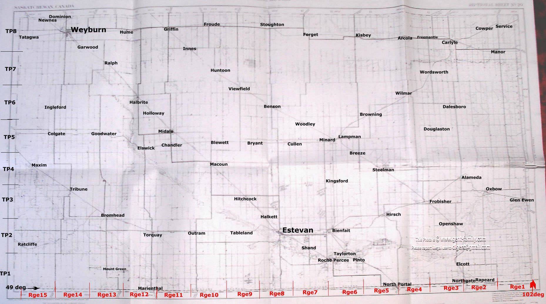
1927
  S.E.  Saskatchewan, Canada
Highway Map
 With Hot Spot Links


 NO Reproduction in Whole or in Part, on ANY, and ALL of my Pages,
 Including Text and Pictures,
 May be made, without the express Written Permission
 of Web Editor, Doug Gent
© 2016

Below is the Full 1927 Map
with Hotspots to Quickly take you
to the Full size Color Maps

It shows Townships on the left or West border
and Ranges on Bottom USA, or south Border
Top of Map is North, right edge is East
I hope this helps you find the place
in SE Saskatchewan your looking for.

Just move your mouse over an area
or Town, Village your interested in
and click, it will open the original map
in full color and detail
Most maps overlap, so try one on each side
to find the best one for you

B/W copy of this corner of the map


My Quick Navigation Bar
Choose Your Next Step From Below

Return to this Map Index Page at any timeClick this Icon to Return to My Home Index Page at any timeClick this Icon to go to Doug's Email Contact PageClick to Return to the Top of any PageClick to go to first Map Page Map Y
Quick Links
SE Sask. Web Pages / Dad's 1927 Map of SE Sask. / Hillside Public School
Estevan Collegiate Institute / Nor-West 1904 Newspaper / Terrace BC
BC Tel Terrace District History / Contact page

No Reproduction in Whole or in Part may be made
without the express Written Permission
 of Doug Gent

Page created by Doug Gent © 2016
June 15, 2001
Revised Apr 17, 2016