My Genealogy and History Page of
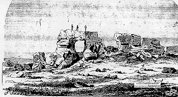
  ROCHE PERCÉE
 Saskatchewan
Canada
 North West Mounted Police


 NO Reproduction in Whole or in Part, on ANY, and ALL of my Pages,
 Including Text and Pictures,
 May be made, without the express Written Permission
 of Web Editor, Doug Gent
© 2016

Want to add a link to my pages?
see my
Copyright Information Page
for the only Authorized Picture Link allowed.
All Pictures on all my web pages, are now Visibly Watermarked,
All my pages are now Right Click, (copy and paste), disabled.
I ask everyone that enjoys free history sites,
to start policing these violations.
If we don't stop this, no one will donate pictures to me, or anyone,
and we all loose.
If you see one of my pictures on Facebook, etc.
tell them to remove it.


The NWMP (NORTH WEST MOUNTED POLICE)
forerunner of the RCMP
(ROYAL CANADIAN MOUNTED POLICE)
stopped at Roche Percee
and this is an actual account below from the
diary of  Henri Julien
July 25, 1874
We reached Roche Percée. This singular rock is a white sandstone
of wind formation, running up like a crest from the bottom of the Souris Valley.
At its base. it measures about 35 feet in height and the base about 140 feet.
Some parts are softer than others, and from the combined influence
of wind and rain, fissures and holes have been worn through it.
On different parts of the rock are cut the names of people
who have passed by and many hieroglyphics which, of course,
remain a mystery to us.
                                           -Henri Julien

Sketch by Henri Julien in 1874


On Wednesday, May 26, 1999, at 1600 hrs
this March was re-enacted into the Village.
 

Click to enlarge in a new window
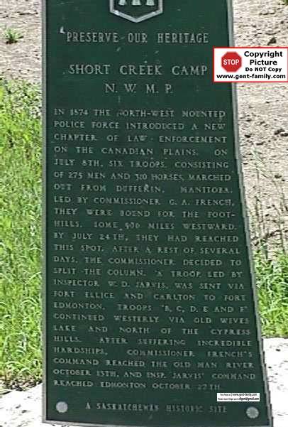
CLOSE-UP OF THE PLAQUE
SHORT CREEK NWMP CAMP

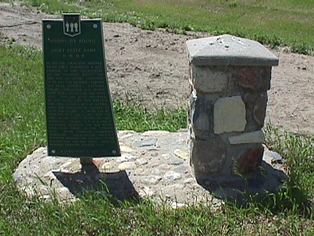
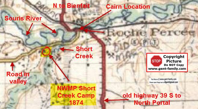
NWMP Cairn supposed to mark the spot where the NWMP camped
on July 25, 1874,
on their way to Fort McLeod, AB
This was NOT the Exact location of the Short Creek Camp.

Now have heard from 2 sources,
the location of the camp was actually
on a piece of land owned by the Langen family today (2011)
and used as a hay field.

The Real location was the West side of Short Creek
(Riviere Courte)
south of the Souris River and SW of Roche Percee.
All based on an original sketch of the camp,
from 1874, compared to views today.

Original sketch, note NOT my web site!
http://www.ourheritage.net/julien_pages/Shortcolor.html


part of my Dad's 1927 map of this area

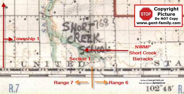
Camp location SW Section 25 , Township 1, Range 7, W2

lat- 49- 03- 50 N
long- 102- 49- 10 W

Elev 535 ft

It is a bit of a mystery why the Cairn is in downtown Roche Percee
but probably a way for tourists to take pictures
of the general area it was in,
without disturbing the Langen family.

Please note- I would ask anyone going there,
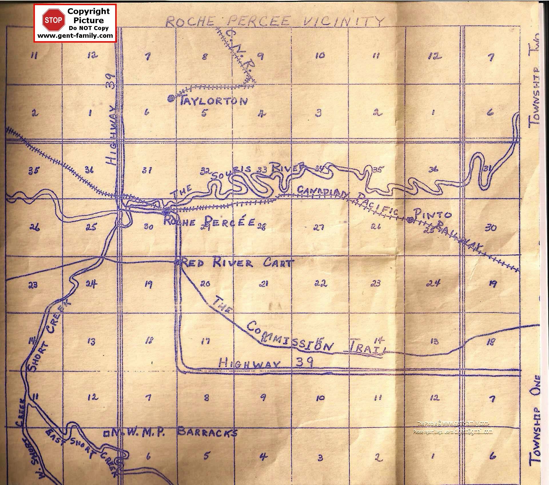
respect their wishes, and stay off their land,
Without asking their permission first.

1955 map showing this location
http://gent-family.com/RochePercee/E.%20Map.jpg

NWMP had a Barracks down near the USA border
NE Section 1, Township 1, Range 7, W2

See my Estevan  NWMP Wood End Museum Page
For more Pictures from this event

Ext Link
Note- NOT my site,
Links may or may not work in the future

Diary of Henri Julien
 http://canadachannel.ca/HCO/index.php/The_Diary_of_Henry_Julien


Return to Main Roche Percee Index Page Return To Top Of  Page


No Reproduction in Whole or in Part may be made
without the express Written Permission
 of Doug Gent

Page created by Doug Gent © 2016

Quick Links
Personal Family Pages
SE Sask. Web Pages / Dad's 1927 Map of SE Sask. / Hillside Public School
Estevan Collegiate Institute / Nor-West 1904 Newspaper / Terrace BC
BC Tel Terrace District History / Contact page

View the Feedback I get on my Roche Percee Pages
Click Here