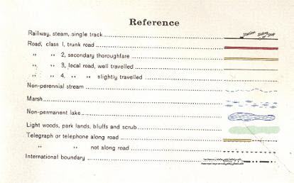
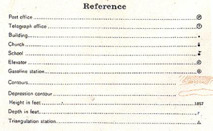
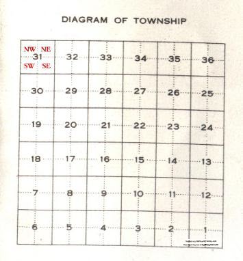
|
Portion Tsp 4, Most of Rge 2, W2
Alameda
Portion of name showing
Homestead Map (not my site) |
Portion Tsp 4, Rge 1, W2
Orangedale School #115
SW Section 2
Settlers in the area
were loyal Orangemen from Ireland
and the School name was derived
from that.
It was one of the earliest Schools
in what was NWT at that time.
Homestead map (not my site) |
|
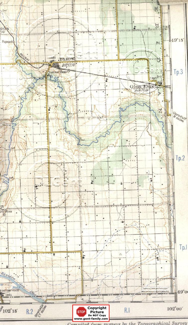
Tsp 3, Most of Rge 2, W2
Oxbow
Section 25
(Note- Latin for Oxbow is Boscurvis)
Town, 1902 Ft. Elevation
Sec 23, Township 3, Range 2, W2
Latitude- 49° 13' 48" N
Longitude- 102° 10' 09" W
Town of Oxbow Web site
Oxbow History Book, Vol 1
Oxbow History Book, Vol 2
(Note- Not my web pages, links may or may not
work)
My little
Oxbow
site
Rapeard
NE Section 32
CPR train siding,
East 1/2, Sec 32, Township 3, Range 2, W2
There was a Water Tower
and Y in the Rails at this point.
ca 1907-1909 this Water Tower was removed,
and a new Train Water system
installed in Oxbow.
Siding named after Robert A. Peard,
born in England, age 25 in 1906,
immigrating in 1902?,
CP Train dispatcher in Brandon,
(Name
Info per Bill Barry's book, "People Places").
my little
Rapeard site
Oxbow School #225
Bow School #165
NE Section 2
Homestead map (not my site) |
Tsp 3, Rge 1, W2
Glen Ewen
SE Section 13
Latitude- 49° 12' 36" N
Longitude- 102° 01' 04" W
Village,
1824 ft. Elevation
Glen Ewen History Book
(Note- Not my web page, link may or may not
work)
Churches
Unknown Church No 1
SE Section 9
Schools
Glen Ewen #506
Auburn School #141
NW Section 16
Homestead map (not my site) |
|
Tsp 2,
Most of Rge 2, W2
Marconi
SE Section 10, (not shown on map)
named after
Marchese Guglielmo "Marconi"
inventor of the wireless radio.
Marconi School #1313
SE Section 12
history book says NW corner Section 10 was the site
of first Marconi School
2nd site per history book was
SE corner of Section 10, Tsp 2, Rge 1
neither shows the location on this map?
Homestead Map (not my site) |
Tsp 2, Rge 1, W2
Hope Methodist church
(icon not shown on map)
SE Section 9
Poplar School #801
NE Section 7
Hope School #117
NE Section 11
First Hope School, NW Section 10.
Established in 1888
Homestead map (not my site) |
|
Tsp 1, Most of Rge 2, W2
Boscurvis
NE Section 14 (not shown on
map)
(note- latin for Oxbow is Boscurvis)
Had a Post Office, opened July 1, 1885
closed Apr 3, 1916, William Galloway
the one and only Post Master
St.
Peter German Lutheran Church
SE Section 32
Walter Herbert Shaw
had a Homestead Grant on this land
Kopperud Lutheran Church
SE Section 18
Boscurvis Methodist Church
NW Section 14
Scout Hill School # 617,
SW 1/4 Sec 21, Township 1, Range 2, W2
Henry Angus Evans
had the homestead grant on this lot
Homestead map (not my site) |
Tsp 1, Rge 1, W2
Meridian
NW Section 24
(not shown on this
map)
Hope Prebyterian Church
NE Section 28
Schools
Kimberly School #176
SE Section 13
Boscurvis School #78
NW Section 18
homestead map, (not my site) |


