|
|

 |
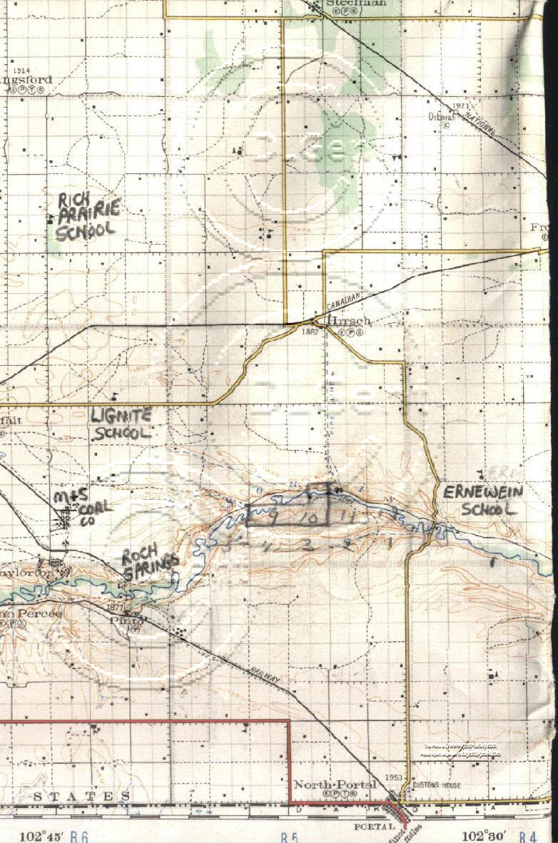
1927 S.E. Saskatchewan, Canada Highway Map |
 |
SHOWING TOWNSHIP 1, 2, 3, AND A SMALL PORTION
OF 4
IN PART OF RANGE 4, ALL OF 5, AND PART RANGE
6
Includes towns of:
Steelman,
Deborah
Hirsch,
North Portal,
Kingsford,
Pinto,
Taylorton
and the Following Schools:
Ernewein School,
Rich Prairie School,
Lignite School
Britannia School- NW Section 11, Township 1, Range 6, W2
also M & S Coal Company Ltd. and Roch Spring Coal Mine
CPR water pipeline is shown running south from Hirsch
to the Souris River.
My Dad owned the sections highlighted with pencil
just to the west of the pipeline, and the CPR dam there.
We used to cross the river in dad's old 1958 austin
just downstream (East) of the CPR dam.
The old Steam engines needed lots of water.


