|
|
 |
SASKATCHEWAN CANADA 1927 Map Page |
 |
|
|
|
|
SASKATCHEWAN CANADA 1927 Map Page |
|
|
NO Reproduction in Whole or in Part, on
ANY, and ALL of my Pages,
Want to add a link to my
pages?
|
||||||||||||||||||||
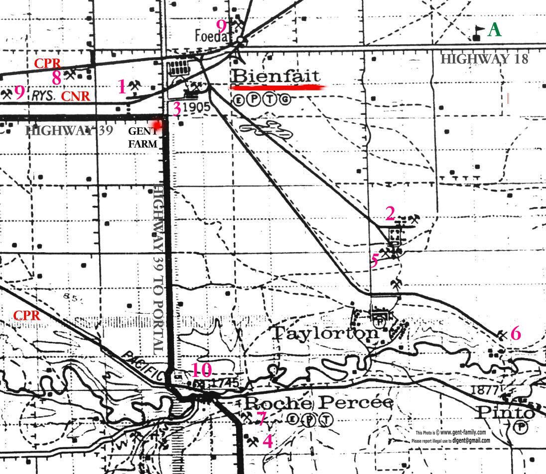
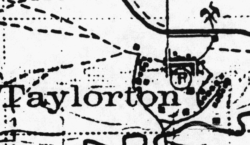
1927 MAP SHOWING LOCATION OF TAYLORTON Key: the P and T in the circles stands for Post Office and Telegraph Office respectively the little E in the circle indicates an elevator in the town the little G in the circl stands for a Garage in the town The number 1905 under Bienfait is the elevation in feet above sea level - - - dash line indicates road small thin solid line is a Railroad Heavy solid line is a Highway little crossed pick and shovel symbols are Coalmine locations I have numbered these Coal Mines, and will try and name each mine eventually
One of the students here was Olga Kingdon They had a ceremony a few years ago to raise a cairn in the yard where this school stood. A small book was written on it's history for the occasion Both of the maps above are left quite large on purpose
|
||||||||||||||||||||
|
ORIGINAL MAP IS TITLED "WEYBURN" Shown Bottom center SECTIONAL MAP # 20 shown in upper right corner This map was produced by: the Office of the Topographical Survey of Canada, Ottawa in January of 1927, Department of the Interior Hon. Charles Stewart, Minister; W. W. Cory Deputy Minister is printed at the top of the Map It is compiled from surveys by the Topographical Survey of Canada up to Sept 1924, and from information supplied by Dominion and Provincial Departments and by Railroad Companies It is a Revision of map of Sept 1917 It comprises an area from Tatagwa just west of Weyburn, top left corner to south of Ratcliffe (West of Torquay) bottom left to East of Northgate in bottom right to north of Manor upper right or to be exact, Tp1 to Tp8 (south to North) R1 to R15 (East to West) West of Second Meridian Original scale 3 miles to one inch (note- maps above have been blown up before scanning, so scale isn't the same) It is a very stiff paper, and quite yellow and brittle _________________________ No where on the map is shown a copyright symbol therefore I feel safe in reproducing it here. The original price my Dad, (or his Dad), paid for it was 25 cents If it was in a folder form, it was 50 cents Hope you enjoy it! |
 |
 |
|
No Reproduction in Whole or in Part may be made
Page created by
Doug Gent © 2016
View the Feedback I get on my
Taylorton Pages |